On a number of occasions, I’ve been identified by someone—even by a close loved one or two—as “fearless.” While I’m thankful that my more adventurous chapters have in some small way inspired some people to embrace adventure for themselves, I’ve never quite felt like attaching the word “fearless” to me is helpful, let alone accurate. Instead, it’s more accurate to say that I am quite in tune with my fears: I consistently make intentional efforts to identify, evaluate, and do what I can to confront the fears that are holding me back from being all I was created to be. I want to breathe through my fears, rather than let them suffocate me.
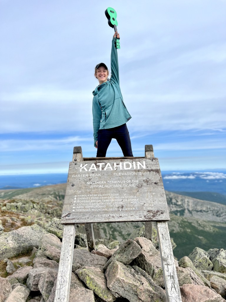
This month, I’ve been writing about the experiences over the past year that I’ve been most thankful for, and this week I’m focusing exclusively on my thru-hike of the Appalachian Trail (AT), a five-month journey I completed on November 16, 2022. I look back on the entire experience with nothing but thankfulness (enough to say I’d do it again, even!). When my hike comes up in conversation, though, the typical first responses don’t come from a place as positive as where I am with it: “What made you want to do that?” “Wow, I could never do that.” “What was the craziest or scariest thing that happened out there?” “Did you do that alone? You didn’t do it alone, did you?” “Weren’t you afraid?”
Some more reflective, optimistic friends ask, “What’s the biggest thing you took away from that whole experience?” For a year now, I’ve been trying to reflect on what my honest answer to that question would be.
As I jotted down some stand-out memories from my hike, I noted a connecting thread through many of them: Many of my favorite trail moments came when I let go of a fear, or confronted a fear, or just breathed through a fear. They came when I embraced the words I first heard in The Princess Diaries (there attributed to Eleanor Roosevelt): “Courage is not the absence of fear, but rather the judgment that something else is more important than fear.”
So, if you’ll take a walk with me, I’d like to share a bit about some of the times out on the AT when yes, on some level, I was afraid. I’m so thankful for all of these moments. They’re the moments that taught me the most about myself, and about the things I know to be more important than fear.
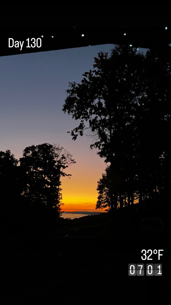
Fear: I might be alone out there.
State: Pennsylvania | Miles walked: 70.1 | Miles to go: 2,124.2
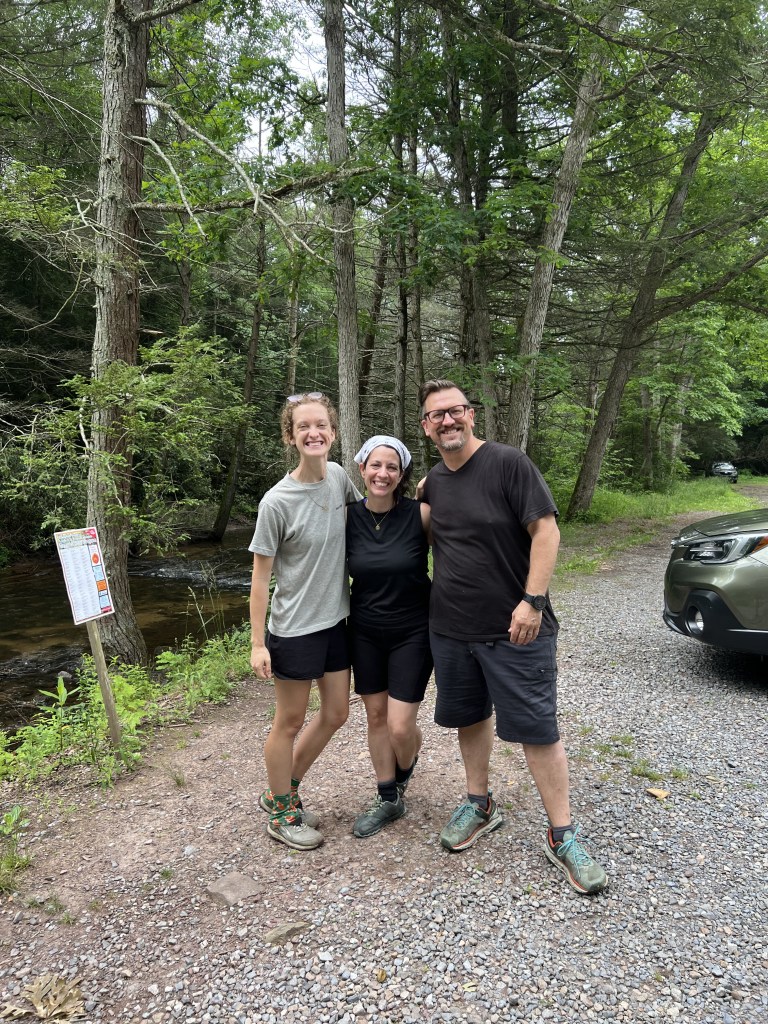
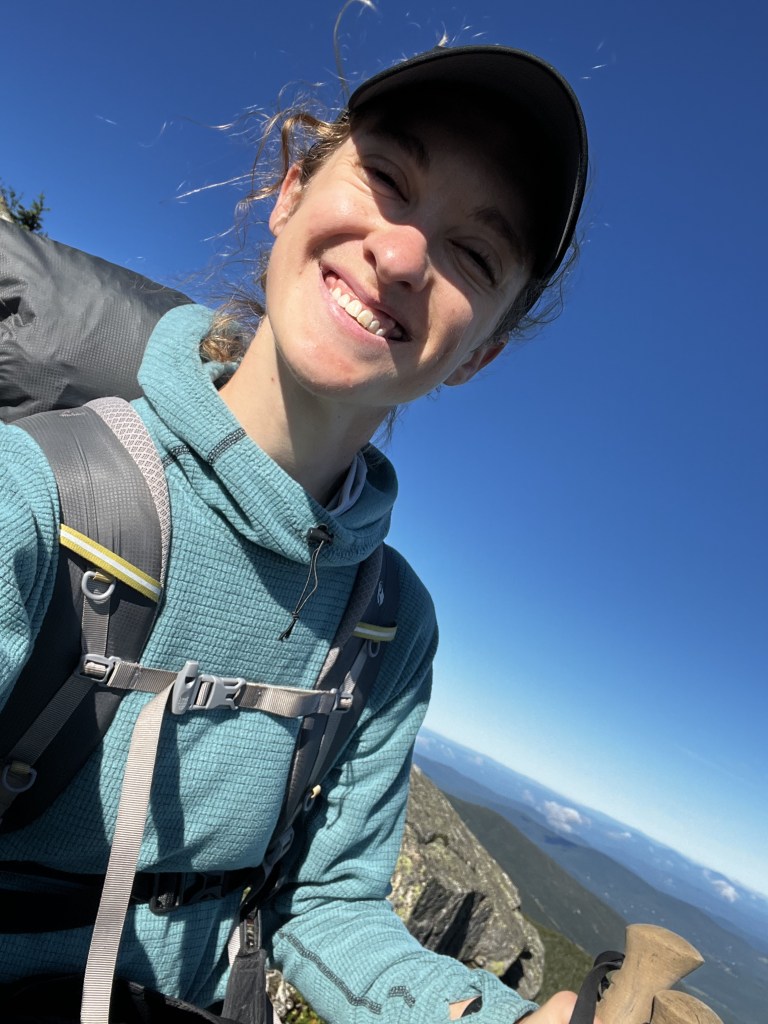
My dad came with me for the first week of my hike. He and I talk a lot, and on my adventures, he’s always prioritized coming out (whether to Tallahassee, London, or Osaka) to visit, to see for himself what my context is like—so he can picture it in his head a bit more when we talk about it on the phone. We set out together from Harper’s Ferry, West Virginia, on June 2, and we walked 70.1 miles together through Maryland and into Pennsylvania (farther than we’d planned—Go Dad!) before his friend Mark came to pick him up and take him to the airport. It was really nice to have Dad there as I got my bearings: I got comfortable setting up and taking down camp and prepping food; we did my first resupply together; and I could see what gear I truly needed and what I could send home with him. As his time on trail was winding down, I knew I was just getting started, and I was truly excited for the hike ahead.
When Dad and Mark dropped me back off at Shippensburg Road and I started walking north into the woods, this time alone, it felt different. I felt a bit like I did walking through the terminal of the Fort Myers airport when I was moving to Japan back in 2016. I knew good things were ahead, and I knew I was where I was supposed to be, but the huge amount of unknown was also a bit daunting. I didn’t have any pictures in my head of what was coming. (I’d even purposefully not looked up photos from other people’s hikes. I couldn’t picture any of the trail in my head, and I wanted it that way so I could come in free from expectations.) I muttered aloud, “Be strong and courageous. Be strong and courageous,” just like I did while walking through the airport.

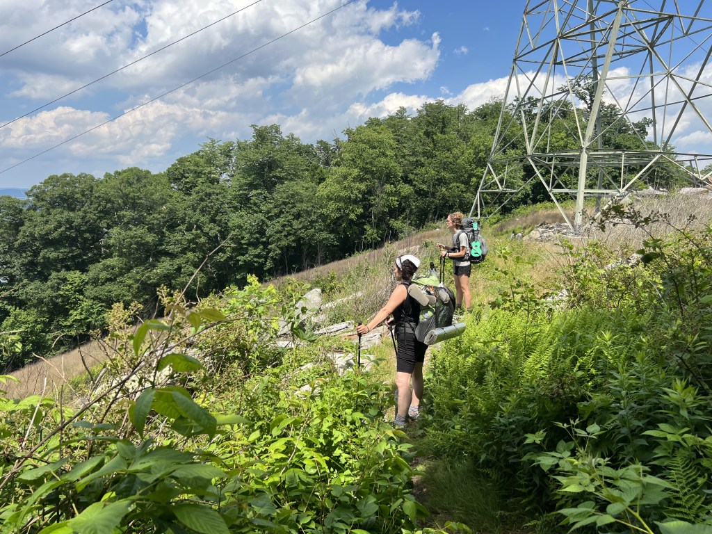
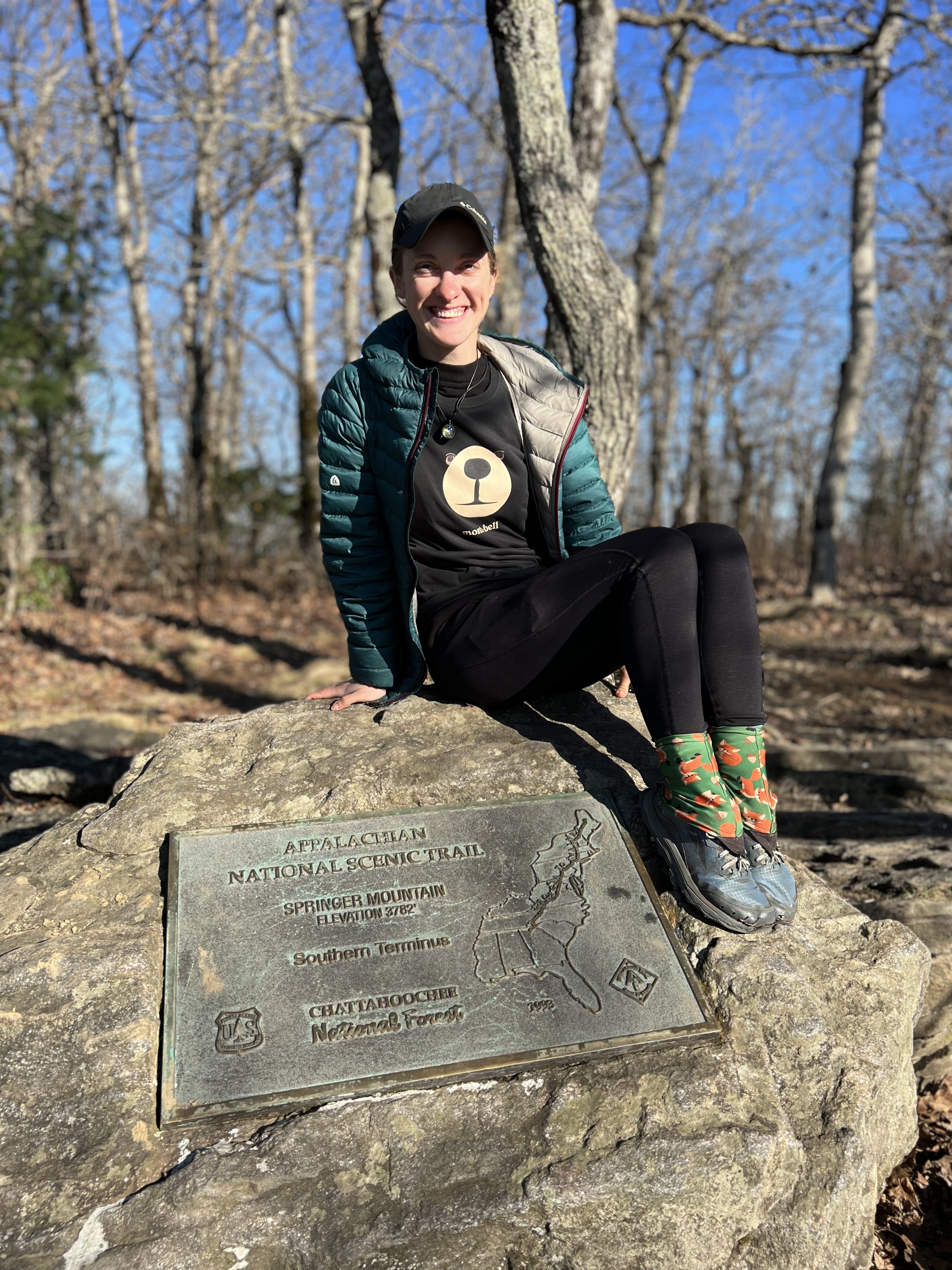
During that first week, I met many other thru-hikers. Everyone had been pleasant, and most had also been open and conversational. Many, I’d noticed, had already formed “tramilies” (a shortened form of “trail family”), hiking with a group of people they’d met early in the hike and formed a close bond with. Those who’d started down in Georgia had walked half the trail at this point, some of them already three months in. I, on the other hand, was just coming in and starting in the middle, at Harper’s Ferry. I’d walk north to Mount Katahdin in Maine, and then I’d head back to Harper’s Ferry and walk south to Springer Mountain in Georgia (for what’s called a “flip-flop thru-hike,” which I’d chosen primarily because of my grad school schedule).
I felt like a freshman coming in, surrounded by upperclassmen who already had a clique of friends, or who otherwise were set in a rhythm and comfortable doing their own thing. At camp, people would bond over experiences they’d had on sections of trail I hadn’t seen yet. (Apparently there were eight straight days of rain in “the Shennies!”) I felt out of the loop, and a bit awkward at times. Was this junior high school all over again?
In that context, I needed to embrace one of the most common mantras in the long-distance hiking community: “Hike your own hike.” In fact, I’d need to do that for my entire hike, as I’d be back in the same boat (or, back on the same trail) when I went back to Harper’s Ferry and started walking south with all those who’d met each other in Maine. In retrospect, I’m very thankful for this entire exercise. (No pun intended.)
The day Dad left, on that first day of truly hiking solo, I walked 15.8 miles—a new personal record. I hiked past two other campsites 10.9 miles and 12.3 miles in for the day, but I felt strong and wanted to push my limits. As I got to where I thought the side trail off to James Fry Shelter was supposed to be, I wasn’t seeing anything. Had I missed the sign and passed it already? The sun was starting to set, and I was nervous I’d have to find my way both to a campsite and to a water source in the dark. Shoot. As I walked and checked my phone, wondering if I should turn back, a man hiking south came around a bend in the trail, walking towards me. Oh boy, here we go, you’re OK. “Hey,” he said, “Have you passed the James Fry Shelter?”
“I’m actually not sure,” I said. Phew. “I’m looking for it, and I was just starting to wonder if I’d missed it.”
“Well, maybe I’m the one who missed it,” he said. “My buddy’s waiting there for me, but I don’t have service here…It’s been long enough that maybe he’ll come looking for me soon enough, though.” He paused, consulting his map, and said, “You know what, it really looks like I may have missed it.” He turned around, and we both walked north for what felt like much farther than it was supposed to be. Eventually we came across a wooden sign indicating that the James Fry Shelter was 0.2 miles down a blue-blazed side trail (though it had to be at least 0.3. Hikers, you hear me?). As we turned off the AT, his buddy approached. I was happy for him, and I walked on ahead of them to camp, not expecting anyone to be waiting for me.
As it turned out, people were waiting for me there, but none of us knew it: That’s the night I met Ross and Amie. As Ross set up a hammock and Amie prepped dinner at a picnic table, I set up my tent and we called out greetings to each other. When I finished, I went over and joined them, and we talked about how our hikes had gone that day.
They asked what wildlife I’d seen so far on my hike, and I mentioned the adorable little deer Dad and I had seen. “Did it have its spots still?” Ross asked. “I think it’s so neat that God made deer like that—what a beautiful attention to detail, you know?” he said.
“Absolutely!” I said, taking note of the fact that he believed in and readily praised God. I learned that Ross and Amie were out for a week, and that in a few days they’d be driving “back to Ohio,” where their young son and daughter were staying. “Ohio?” I asked, “I was born in Ohio. Whereabouts?” As it turned out, Amie and I were born in the same hospital in Toledo. What were the chances? From Ohio, they’d be driving back down to the Atlanta area in Georgia, where they’d moved to start a church back in 2005. A pastor’s family? What were the chances?
We didn’t plan to align our mileage and campsites for the rest of their week out on the AT, but that’s what happened. While we didn’t walk together throughout each day, we’d run into each other at a water source and chat, or I’d come across them taking a snack break and join them. We’d share our plans, and they always seemed to match.
I had a lot of trail firsts with Ross and Amie, and that week I got even more comfortable and ready for the rest of my hike. We stayed together at Lisa’s Hostel in Boiling Springs, and unexpectedly at Kind of Outdoorsy in Duncannon on a rainy evening. These were my first hostel experiences on trail. Amie shared some of her homemade dehydrated curry with me and told me about the prepping process, and Ross taught me how to tie a square knot and a slip knot so I could hang my food from a tree (up away from wildlife) more easily. I also picked up on some useful features of a navigation app from them.
Not only did I not need to fear the possibility that I’d be left out on trail family life; I got a great one, perfectly made for me. On a Saturday night at camp, I asked them if they’d want to worship together the next morning, and they enthusiastically agreed. Sitting outside their tent next to a little morning campfire, I played “How Great Thou Art” on my ukulele and they harmonized with me through the choruses. Amie prayed, and Ross read and shared a message with us. That remains one of my simplest, sweetest trail memories.


On their last day, we intentionally walked together so we could talk even more. For seven miles, we shared our biggest burdens, with transparency and vulnerability, and eventually we stopped in our tracks to pray with each other. I felt truly privileged to hear their hearts and take up their burdens with them, and I felt so grateful to meet people with whom I could so quickly be my honest self. They became like trail parents to me, and I still consider them my original trail family. Somehow, it was just as hard to say goodbye to them as it was to say goodbye to my actual dad a week before, but I was also just as grateful for our time together. “Let us know when you get to Georgia!” they said before they left. “We’ll come get you from Springer!” (And they really did.)
They got into their shuttle at PA 325, 55.3 miles north of where we first met. I waved goodbye and walked north into the woods, alone again. This time, I couldn’t wait to see who else God was going to put on my path. I knew I wouldn’t be doing this all alone.
Lesson learned:
“I will not leave you as orphans; I will come to you.” (John 14:18)
Fear: Everyone else is afraid… Are they right?
State: New Hampshire | Miles walked: 778.8 | Miles to go: 1,415.5
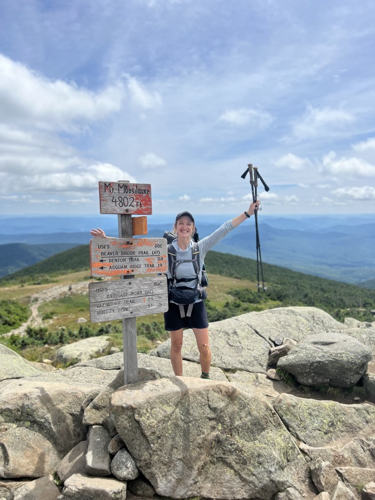
I entered the White Mountains of New Hampshire on July 29, with Mt. Moosilauke. I’d been hearing about these mountains since my first days on trail. Back in Maryland, standing next to me at a sink at a campground, a fellow solo female thru-hiker (trail name: Dandelion) shared some words of encouragement with me, while also being forthright about the number of people who would want to give me unsolicited advice and commentary: “I swear,” she said, “if one more person tells me, ‘Just wait until you get to the Whites….’”
The mountains had a reputation for being one of the most difficult sections of the AT (if not the most difficult, although as I was finishing them, people assured me Maine would be even harder). As the Whites got closer, and even as we actually got there and started them, talk about them continued to get louder and more frequent.
Several factors contributed to the nervous chatter. Dispersed camping options are known to be more strictly limited in the Whites, for example, so hikers are funneled to paid campsites or pricey huts. The huts are known to take up to two thru-hikers a night to do work-for-stay, but there is a narrow time window for arrival, and if they’re already full, you’d have to keep walking. That makes planning slightly more complicated, especially for anyone hiking in a group. Adding to that stress, the terrain is known to be considerably more strenuous (steeper, for longer, over rougher & rockier terrain) than other sections of the AT. One guidebook introduces the Whites with this note:
“Passage through the Whites should be planned carefully. It is one of the most heavily visited sections of the AT, and campsites are limited. The trail is rugged, so your pace may be slowed. Weather is dynamic, so carry cold weather gear in all seasons and always check the weather before beginning a hike above treeline.”
David “Awol” Miller, The A.T. Guide Northbound, 2022, p. 202
The most talked-about stretch of the Whites is “the Presidential Range” (or “the Prezis”), a collection of thirteen mountains named after US presidents. There are two particularly intimidating stretches of the AT through this range, where hikers need to strategize camping and moving while looking at the weather. (After all, “The Presidential Range is notorious for having some of the worst weather on Earth, mainly because of the unpredictability of high wind speeds and whiteout conditions on the higher summits.”)
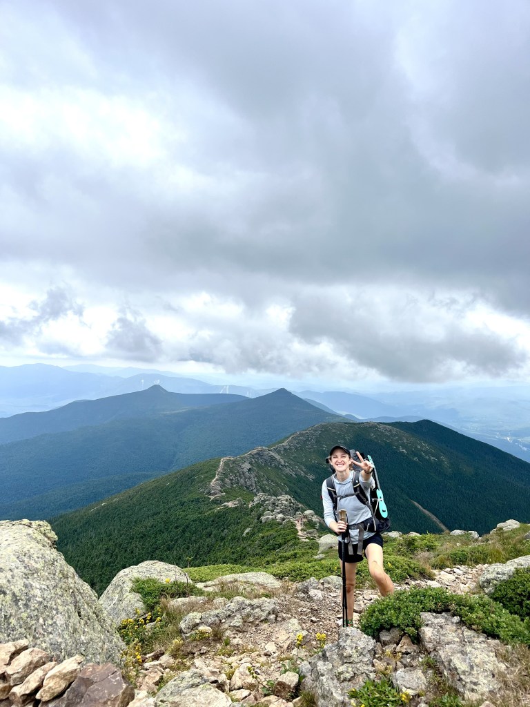
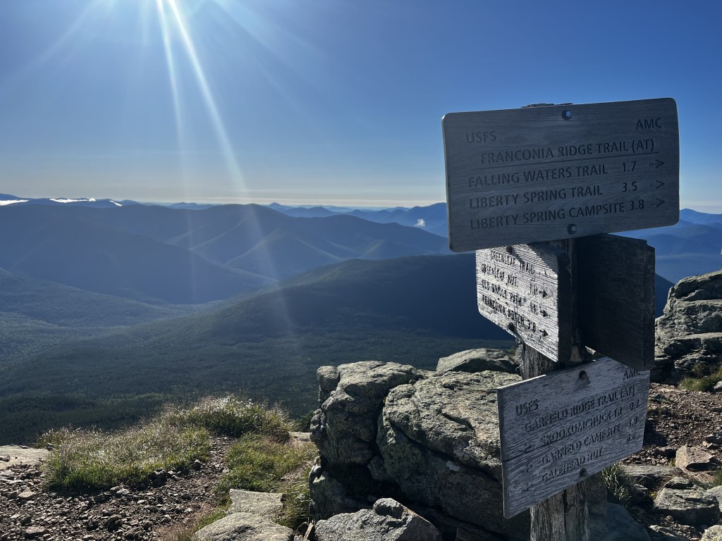
The first tough stretch comes early on: Northbound AT hikers are introduced to the Prezis when they climb up out of Franconia Notch, heading up to Mts. Lincoln and Lafayette for a two-mile stretch known as the Franconia Ridge, which is all above treeline. (For those who don’t know, above treeline, also known as “the alpine zone,” is a dangerous place to be during a thunderstorm, when a hiker turns into a walking lightning rod.) After Lafayette, hikers bob up and down over Mt. Garfield, the Twin Mountains, and eventually down to Crawford Notch. That’s the end of the first stretch.
Next is the “Presidential Traverse,” the second and more intimidating stretch of the range. Out of Crawford Notch, hikers climb up (the very steep) Mt. Webster to Mizpah Hut and Nauman Campsite, the last camping options before Mts. Pierce, Eisenhower, Franklin, Monroe, Washington, Jefferson, and Madison. While there is a hut located just before Mt. Madison, it’s a pricey and unreliable option. Many hikers instead opt to continue hiking, completing the Traverse by climbing down to Osgood Tent Site, or to the next trail town, Gorham. It’s just about 15 miles (14.8 by my guidebook’s calculation) from Mizpah Hut on the south end of the traverse to Osgood on the north. With frequent late-afternoon storms in the area, timing that hike can be a tough task. It’s not unusual for hikers to have to camp out for an extra day, or even several days, waiting for a weather window to open up to race across the range and complete their Presidential Traverse.
It would be one tough section and then another. All of this was on the minds of the hikers around me as I climbed Mt. Moosilauke on July 29. Even more people discussed it the next day on the Kinsmans, the last climb before the Presidentials. Tomorrow it would finally be here.
But here was the thing: The entire week ahead forecasted rain, and everyone wanted to talk about it. Everyone wanted to compare plans, gauging by other hikers’ itineraries how scared to be of the forecast. Many hikers debated stopping and taking “a zero” (a rest day, when you hike zero miles) or two (or more) at a hostel, waiting out the weather. Others, on a time crunch to complete their thru-hike, considered taking a shuttle and skipping this entire stretch, coming back (supposedly) to complete it sometime in the future.
The more people talked, the more fearful the conversations sounded. People traded worst-case scenarios, thinking creatively about the kinds of things that could go wrong up there. “What do you think, Bears?”
“I dunno,” I said. “The rangers I’ve been talking to have said that it’s really common for there to be late-afternoon storms up around Mt. Washington, so I’m not surprised there’s rain in the forecast. Maybe I’m kind of used to that concept from Florida’s rainy season? The forecast says rain every day, and all the locals know not to make plans outside from 3-5pm. You can expect the rains like clockwork. I feel like this might be kind of the same deal, and I feel like it’s gonna be fine. I don’t want to just take days off out of fear…We can adapt, right? We’re not stupid. I dunno, I feel hopeful.”
“Just wait until you get 1,600 miles into your hike,” one person said. “You’ll get why we feel this way.” Yeah? Bet.
Fear kept creeping into the conversations as we climbed, with me walking in front and the nervous conversation floating up to me from behind. I felt the fear trying to work its way into me, and I instinctively started walking faster. And faster. And faster, until I was literally running. (I don’t always recommend running from fear, but sometimes it does the trick!)
With nothing but the sound of my own feet hitting the ground, I felt free again. “Free as the mountain air,” as Atticus Finch would say. In my own headspace, there was clarity again. When I reunited with the gang at Lonesome Lake Hut for some soup and lemonade, I felt recentered and sure.
Many did end up taking a zero that day, staying at a (lovely, top-tier) hostel called the Notch. Before bed, people confirmed with each other plans for the next day, and I said I’d check the weather again in the morning, but I was planning to continue north. One other hiker (trail name: Lavender) said she was considering doing the same.
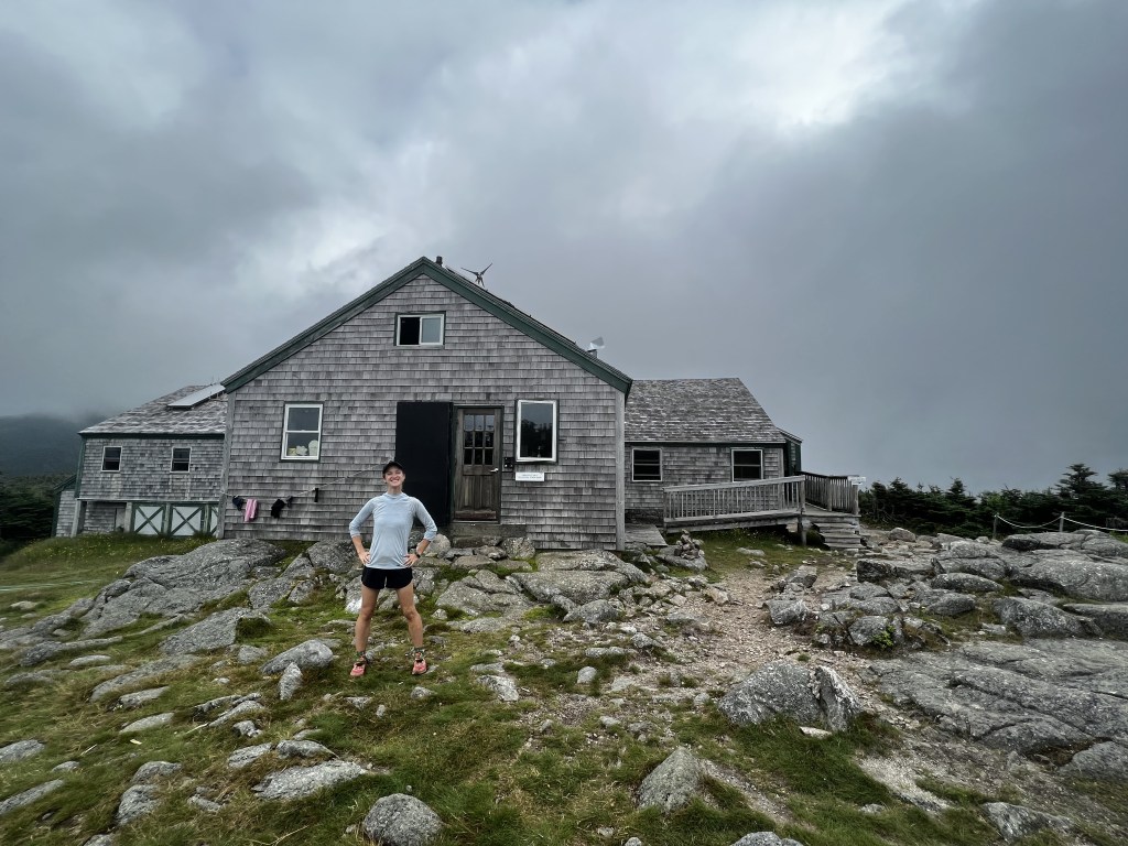
Lavender and I did hike out that morning. We made the steep climb up to Liberty Spring Campsite, where we’d told ourselves we could look at the weather and decide whether to continue up into the alpine zone. It looked like the storms would stay at bay long enough to get over Lincoln and Lafayette, and we told ourselves we could always take the 1.1 mile side trail down to Greenleaf Hut to ask about work-for-stay if the weather turned on us. We were nervous about what we’d do if they were full, but we told ourselves the odds were low that other hikers would want to do that steep climb down and back up.
The views were beautiful as we hiked over Franconia Ridge toward Lafayette, but the dark clouds quickly moved in, until we had a whiteout on top of Lafayette. We started the side trail down to Greenleaf Hut in the rain. When we arrived, we got some soup and debated asking the staff about the work-for-stay. It wasn’t even 2:30pm yet, so we were too early for the typical work-for-stay arrival time (4pm), and we’d both heard stories of huts turning hikers away, telling them to keep hiking if there was still that much daylight left.
Lavender went up and asked one of the staff, and we were relieved to hear they were excited to have thru-hikers want to stay. (Apparently, it was in fact rare for people to make the hike down!)
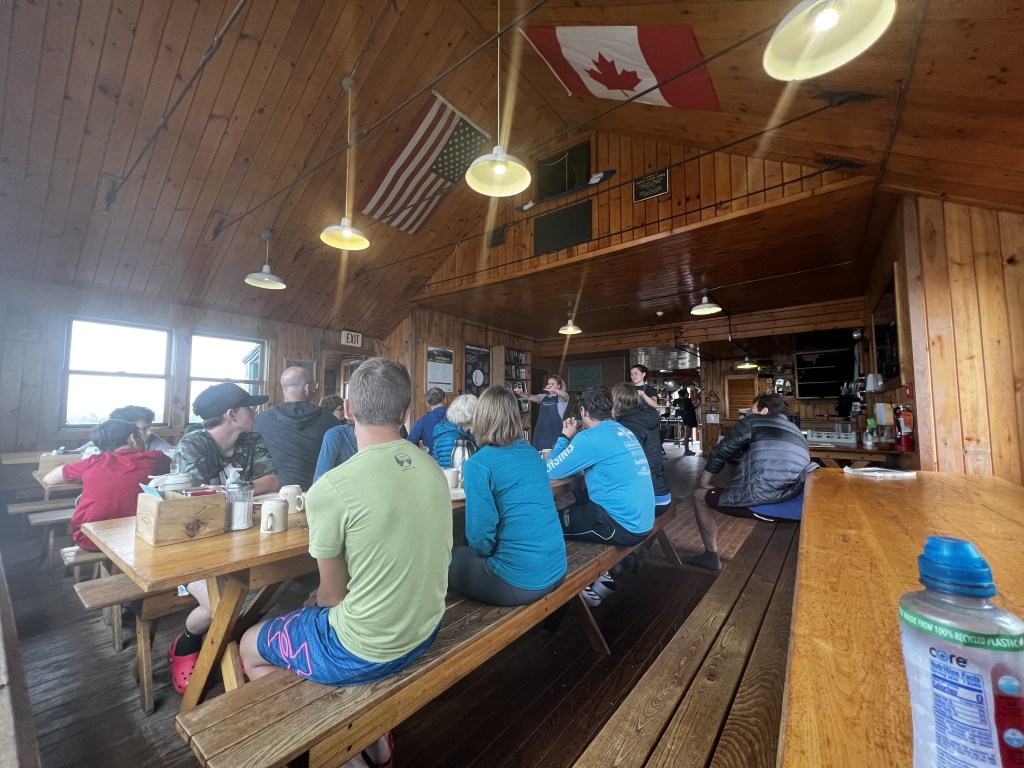
We were told we could hang out until the paying guests were done with dinner, and then we could help ourselves to leftovers. After dinner, we’d sweep the hut floors, and in exchange we could set up our sleeping pads and bags up on the dining room floor. Free food, light work, and a warm place to stay the night? It was so worth it. We hung out, played games and talked to the guests, who were eager to talk about what it was like to thru-hike the AT.
We had our stuff cleared before breakfast started at 7am. We hiked the side trail back up to Mt. Lafayette, which we had to ourselves to take in the beautiful early morning sun, and then we hiked north, each at our own separate pace.
Lesson learned:
“Peace I leave with you; my peace I give to you. Not as the world gives do I give to you. Let not your hearts be troubled, neither let them be afraid.” (John 14:27)
Fear: What if I’m too hurt to make it?
State: New Hampshire | Miles walked: 805 | Miles to go: 1,389.3
That same day, hiking alone up Mt. Garfield, I took a giant step up onto a boulder. As I lifted myself up, I slipped. My left knee twisted to the left and majorly hyper-extended, and I fell backwards. Hard. I cried out in pain, but no sound came out. I looked at my palms, which had caught me while scraping hard against rocks. They burned, and countless small red dots slowly got bigger and darker with blood. I sat there for about thirty seconds, feeling like a helpless, confused child. Then I stood up, putting my hands on the rock I’d tried to step up on, pressing as hard as I could to bring myself to my feet. I used my other leg this time and hoisted myself up the rock. As the shock wore off, I continued taking steps, but each time my left foot hit the ground, I audibly winced in pain.
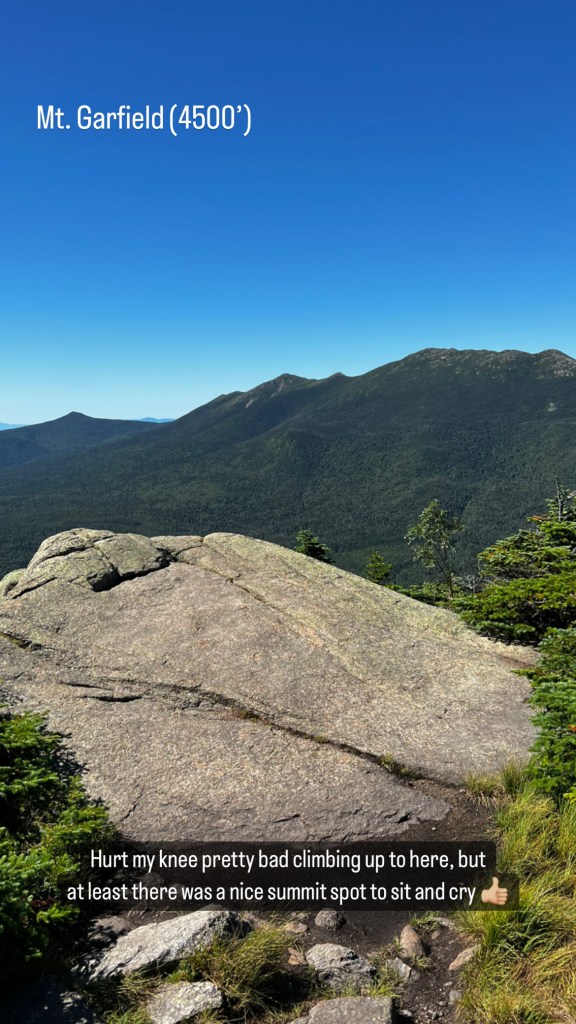
When I made it to the summit, I sat at the overlook and just cried for a bit. How was I going to get down like this? It was 0.4 miles down to Garfield Ridge Shelter, with over 500 feet of elevation drop in that short distance.
Some day-hikers came up to the summit as I sat there. “Are you OK?” an older gentleman asked. “Want some ibuprofen? I’ve got a bunch.” I gratefully took him up on that. I sat for a while, had a snack, and let the medicine kick in before continuing to walk.
The hike down was incredibly slow. A small stream flows along the trail down Mt. Garfield, making each step not only steep and rocky, but slippery.
Although the medicine was helping, each step continued to hurt. Two southbound day-hikers approached and made way for me to come around them. One guy offered me his arm down a particularly steep step, and his buddy looked on and said, “You look like you’re in a lot of pain, girl. You want some weed?”
I was so encouraged by the people who continued to cross my path, ready to help. I even felt confident enough to keep walking past the hut. (It wasn’t even 11am yet, and I didn’t feel like sitting around a hut all day.) Galehead Hut was only another 2.7 miles, and Guyot Shelter was another 2.8 after that, and Zealand Falls Hut was another 4.0 after that. I told myself I’d listen to my body and stop when I needed to. For better or worse, I’d take the “walk it off” approach.
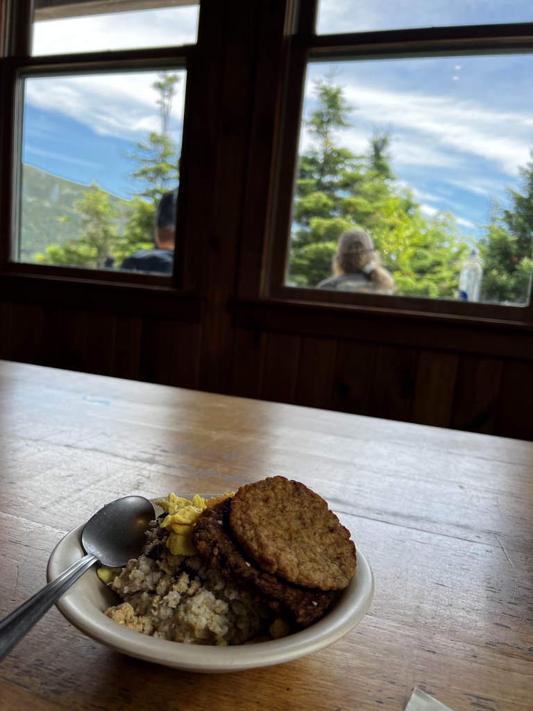
I made it to Galehead Hut right around 1pm. I went inside and asked a crew member if I could do any chores in exchange for breakfast leftovers. She handed me a broom and asked me to sweep the halls, and in return I had my fill of (cold) oatmeal, scrambled eggs, and sausage. I rested a while, and then I kept going.
Just before Guyot Shelter, I came to a fork in the road. The shelter was to the left, following the AT. Straight ahead was a mile-long side trail to Bondcliff, which I’d been told not to miss.
I was above treeline here, and I didn’t know what the trail to the cliffs would be like. I ran into a day-hiker and his dog, returning from Bondcliff. “Are there any camping options along the way there?” I asked him. “Honestly, not really,” he said. “But it’s so worth it.”
I decided it wouldn’t be smart to risk it, especially as the sun began to set. I followed the AT north, only to find the Guyot Shelter at full capacity. I needed to keep walking. The next official spot to stay was Zealand Falls Hut, another 4 miles, including another steep downhill climb. Oh, no. Onward I went.
The pain in my knee started reminding me it was still there, and I felt the energy draining faster and faster from my body.
At this point, over 800 miles into my hike, I’d still never “stealth camped” on my own. I’d stayed at shelters and campsites on my own, or sometimes together with other hikers I didn’t know, but I’d never stopped in an unmarked place and set up camp by myself. The thought had always made me nervous. I think I told myself that I would somehow be more susceptible to falling tree branches and bear attacks if I were in the middle of the woods where no one would ever expect to find a person.
I made it 12.3 miles for the day, just beyond Zeacliff when I could feel myself about to drop from exhaustion. I’d been eyeing the woods around me, having taken stock of the comment sections of this stretch on FarOut. (FarOut, previously called Guthook, is a very thorough app that marks all sorts of waypoints along the trail, both official and unofficial. Users leave comments about things like the status of seasonal water sources, or about hidden campsites.) As I walked, I spotted a few tents relatively hidden, and I felt better about potentially stopping somewhere myself.

I went as far as I could, and when I spotted a relatively flat patch of ground off the trail, I stopped. I set up my tent, ate, and fell asleep reciting Psalm 91:10 like my Oma would: “No evil shall befall me, no plague come near my tent.” I was asleep in a matter of minutes.
I woke up when the sun did, packed up, and kept walking north. I’d stealth camped on my own, and I was just fine.
In an odd way, I’m thankful I got hurt that day. It showed me what I was capable of but hadn’t tried yet simply because I was afraid. In that moment, stopping and resting my knee was more important than fear. I left that campsite with enough confidence not only to repeat the solo-stealth-camping process in the future, but to boldly climb up to tackle the Presidential Traverse the next day. (That’ll have to be a story for another time!)
Lesson learned:
“God is our refuge and strength, a very present help in trouble. Therefore we will not fear though the earth gives way, though the mountains be moved into the heart of the sea…” (Psalm 46:1-2)
Fear: Is this guy gonna attack me?
State: Virginia | Miles hiked: 1,584.2 | Miles to go: 610.1
I hiked out of Woods Hole hostel by myself around 2pm. A whole bunch of fellow SOBOs (SOuthBOund hikers) decided to take a zero day there, but I felt rested and good to go. I had the joyful confidence of a girl who’d just lost a deeply sentimental piece of jewelry on trail and had it returned to her. (Another separate story!) Ducky and Gravy had hiked out that morning, and I figured I could catch up to them.
I felt strong all day, and the trail was easy. (In fact, the whole southern half felt pretty easy after what I’d just been through up in the northeast.) I moved quickly, and as the sun began to set, I made it to the site where my friends had said they were planning to stop. I didn’t see them, so I texted them, and they let me know they’d felt similarly strong that day and had continued another 4ish miles to a dispersed campsite. That sounded good to me, so I put on my headlamp and kept walking.
There wasn’t a water source near them, and we were in a surprisingly dry stretch of trail. Many of the water sources, even ones listed as reliable, were dried up. Looking for water, I stopped at Kimberling Creek, located next to a trailhead parking area a little over a mile before the campsite. The A.T. Guide said of the creek, “drinking discouraged” (70). FarOut’s waypoint note said, “The river is large and drains an area near many houses and farms, so the water is probably not good for drinking.” Still, I didn’t have much choice. I was low on water. I figured, I had my Sawyer Squeeze filter, and a stove to boil the water on top of that. Turning the brightness on my headlamp up so I could see, I slowly stepped closer to the water to take a look.
As I focused, I heard leaves crunching to my left, and I quickly turned my head that way.
“Oh,” a man’s voice said. He’d seen my face before I could find his. “You’re a female.”
Oh no.
“Yeah, hi, just checking out this water source before hiking on to catch up with my friends.” I’m not alone, got it?
“You’re a hiker?” he asked. Two for two, this guy.
“Yeah,” I said, trying to sound casual and confident. “Thru-hiking the Appalachian Trail. Been out here walking for four months now.” I’m not a rookie, got it?
“No shit? That’s awesome. I thought maybe you was one of them fellas coming after catalytic converters.”
“Oh, no, I wouldn’t want to carry that out here,” I said with a light laugh. He loosened up a little.
“You still hikin’ on, in the dark?” he asked. Why do you ask…?
“Yeah, my friends walked on and are just up ahead, so I’m just getting water and going to meet them. I heard this water might not be good to drink, so I was just checking it out.”
“Well, I think it’d be fine to drink. There ain’t no tires in it or nothin’.” Fair enough. “Here, I gotcha,” he said, grabbing my Cnoc bag out of my hand and stepping down into the water. “I’ll fill ‘er up for ya.”
“Oh, um, okay…” I stood there as he struggled to fill the bag. He probably wouldn’t fill up my water bag for me if he were planning to hurt me, right?
“I’m out here huntin’,” he said. Oh, great. “I like to come out when I get a chance. It’s nice huntin’ so close to the trail, ’cause the deer are all used to people ’cause o’ you hikers, you know? They ain’t scared o’ me, so I can get ’em easier.” Lovely…He made his way back up out of the water and handed me my bag of tire-free water.
“Thanks a lot,” I said, “I’d better be going.”
“You walking south? I’ll come with ya. I’ll scout out the place for the mornin’.” Perfect…You want to walk away from the road and into the woods with me…
“Um, alright,” I said, “Lead the way.” No way am I letting you walk behind me where I can’t see you. As he turned, I looked at my phone. No service. Of course. God, help.
“Where you from?” he asked.
“Uh, Michigan originally,” I said.
“No shit?” he said. “The wolverine state, huh? I go up there sometimes for body building shows. I’m a body builder, you know. Pretty good at it, too. Here, I got some pictures.” He pulled out photos of him flexing in a pair of posing trunks. What on earth am I supposed to say to this? Thankfully, he continued the conversation by himself.
“Yeah,” he said, “It ain’t much, but it’s easier than my last job. I used to work up at the prison there, just up the road. You know the one?” He was referring to the New River Valley Regional Jail, I think. Great mental picture, I thought. Really adds to the mood. “Yeah, that place was real crazy. Woo! Real crazy.”
“I’m sure,” I said. How far is this guy planning on walking? Before too much longer, we came across an open grassy area, and he confirmed it as his hunting grounds for the following morning. Still, he kept walking south.
“How far up you planning to go on this little scouting trip?” I asked, again trying to keep my tone lighthearted.
“Oh, not far,” he said. “I just didn’t want you to feel alone is all, ya know?”
What! Dude! You’re the scariest thing out here! I’ve been walking behind you all this time, bracing myself in case you turn around and attack me!
I kept my reply calmer, relieved at least to hear he had no bad intentions. “Oh, that’s kind of you. Like I said, I’ve been out here for months, I’m definitely comfortable walking by myself. I’ve got my light and my phone, and my friends are just up ahead, I’ll be totally fine.”
“Well, alright,” he said. “I guess I’ll be on my way then. You have yourself a good night.”
“Thanks,” I said, “You, too.” I walked on, looking over my shoulder to make sure he was dedicated to his walk back. When the path curved out of view, I looked at my phone again. After a few more steps, I had service, and I called my dad. He answered, and I told him the story. I stood in place, so I wouldn’t lose service again, and my heartbeat slowed back down. We kept the call brief, and then I walked the remaining little stretch to the campsite where I found my friends’ tents.
I was OK. I went to sleep just fine, while making a mental note to maybe avoid walking alone at night past a major road during hunting season. I could continue to be strong and courageous, and I could still be content on my journey out there, while taking note of the fact that hunters liked to be around the AT and adjusting my plans accordingly.
Lesson learned:
“Behold, I am sending you out as sheep in the midst of wolves, so be wise as serpents and innocent as doves. Beware of men…” (Matthew 10:16-17).
Fear: What’s that sound?
State: Tennessee | Miles walked: 1734.8 | Miles to go: 460.5
I hiked out of Damascus, Virginia, as a big SOBO group was hiking in. (I was used to this trend by this point: tempted to stay to socialize, but dedicated to hiking my own hike.) I’d spent the night at the Broken Fiddle hostel, resupplying and doing laundry and charging up my devices. I got 24 hours of rest in, and I decided to do a Nearo (“nearly” a zero day, but still with forward progress), aiming for Abingdon shelter, just past the Virginia-Tennessee border.
The shelter area wasn’t amazing. Tennessee, I’d been warned, was somewhat infamous on trail as the only state whose shelters didn’t have a privy (an outhouse). Instead, you could find a shovel by the shelter and use that to dig yourself a nice cathole to bury waste. A big patch of disturbed ground with softer soil indicated where hikers were in the habit of going.
As I continued with my evening routine of setting up camp and cooking, singing hymns to the trees the whole time, it started to snow. As the sun set, the temperature dropped even more. Snow soon turned to hail. I made moves to hang up my food as quickly but thoroughly as I could. While many hikers (myself included) tended to get lazier and lazier about hanging food the farther into the hike we got without any incidents, I was aware of where I was. This was Tennessee, home to the Great Smoky Mountains. As a kid visiting Gatlinburg with my family, that was the first place I’d ever seen a bear out in the wild. I didn’t want to take any unnecessary chances.
After hanging my food, I crawled into my tent and tried to get warm, the hail continuing lightly outside. I sent a text to a group chat of friends and family with an update:
“All tucked inside my sleeping bag, sealed in and trying desperately to generate heat, but I can’t feel my toes. I’ve been praying for God to carry me through to tomorrow, and for the sun to be warm when it comes up. The highlands were beautiful and fall colors are still so gorgeous—overall still in positive spirits despite the cold.”
Eventually, I stopped shaking long enough to fall asleep. I’m not sure how long I slept, but I woke up suddenly and it was still dark. I wasn’t sure what had caused me to wake up, either, but I shot up in bed and then sat still. I heard thuds in the distance, and frustrated huffs. There wasn’t a doubt in my mind what it was, and what it was after. I was thankful for my diligence.
If this had happened earlier in my hike, physical fear would have made me sick to my stomach, as nightmarish images flooded my head. The longer I walked, however, the more confident I’d grown. I’d seen black bears on trail during the day before, and there had never been a confrontation. They either stood still and watched until people passed, or else they quickly ran away. Instead of feeling sick to my stomach, I took my fear to the Lord. I focused on breathing normally. I thought about what I should do.
I’d learned a memory technique for how to approach bears, based on their color: “If it’s black, fight back. If it’s brown, lie down. If it’s white…Goodnight.”
Man, I thought. I just got warm. Now I’m going to have to get out of my tent, turn on my light and get big and loud and confrontational. Then I’m going to have to come in and go through that whole process of warming up again…
Noting that as my biggest concern, I felt more sure I’d be OK. I turned on the little lights built into the frame of my tent.
“HEY BEAR!” I shouted as the lights went on. “I’M A BEAR, TOO! WHAT’S UP? I’M COMIN ON OUT, GET READY!” I unzipped one of the side doors to my tent. Before I had stood up outside, the bear was gone. My voice echoed out through the woods, and it felt oddly satisfying knowing I’d made those sound waves. I stood still then, taking in the growing, cold silence around me. I felt adrenaline rushing through me, and the only thing I could hear now was my heartbeat thudding in my ears. I got back in my tent, turned out the lights, and focused on getting warm until I fell back asleep.
A day or two later, I saw a Facebook post in an AT group sharing this article, spreading the word to let hikers know the Abingdon Shelter had been shut down due to “aggressive bear activity.” Apparently, the day after I’d stayed there solo, a bear had bluff charged at some hikers walking through.
For the rest of my hike, as I continued on through bear country and in hunting season, I remembered how I’d breathed through my fear that night. I remembered how my gut response was to cry out to God, and how assured I’d felt that even if something were about to happen to me, in an ultimate sense, I was OK.
That wouldn’t be the last night I’d have to walk and talk myself through fear. With only a thin layer of nylon between me and the great darkness of the woods, any little sound could seem louder and more threatening than it may really be. (Sometimes it really was a bear or a bobcat, though.) There were plenty of times I felt profoundly aware of how dependent I was on God to get me through the night. Every night, I fell asleep, and I slept soundly, and I woke up with the sun. I told myself I wanted to take that same sense of dependency home with me from the trail.
Now, I’m sitting at a dining room table in my apartment in downtown Detroit. The sun has set, and it’s cold. Before long, I’ll crawl into my bed and go to sleep, and it’ll feel easier than it did in my tent to fall asleep with confidence that I’ll make it through the night. But I am just as incapable of sustaining myself independently in here as I was out there. And that’s OK, because I never have to do it alone, and I never will.
Lessons learned:
“I lay down and slept; I woke again, for the LORD sustained me.” (Psalm 3:5)
“When I am afraid, I put my trust in you. In God, whose word I praise, in God I trust; I shall not be afraid. What can flesh do to me?” (Psalm 56:4)
“Choose the great adventure of being brave and afraid at the exact same time.” – Brené Brown
Sources:
- “Camping Closed at Abingdon Gap Shelter Due to Bear Activity.” USDA. 28 October 2022. Accessed November 14, 2023. https://www.fs.usda.gov/detail/cherokee/news-events/?cid=FSEPRD1069700
- Miller, David “Awol.” The A.T. Guide: Northbound. AntiGravityGear, 2022.
- “The Presidential Range.” Wikipedia. Accessed November 14, 2023. https://en.wikipedia.org/wiki/Presidential_Range

Leave a reply to Sue Haynes Cancel reply